

By LYNETTE HAALAND, Four Points News
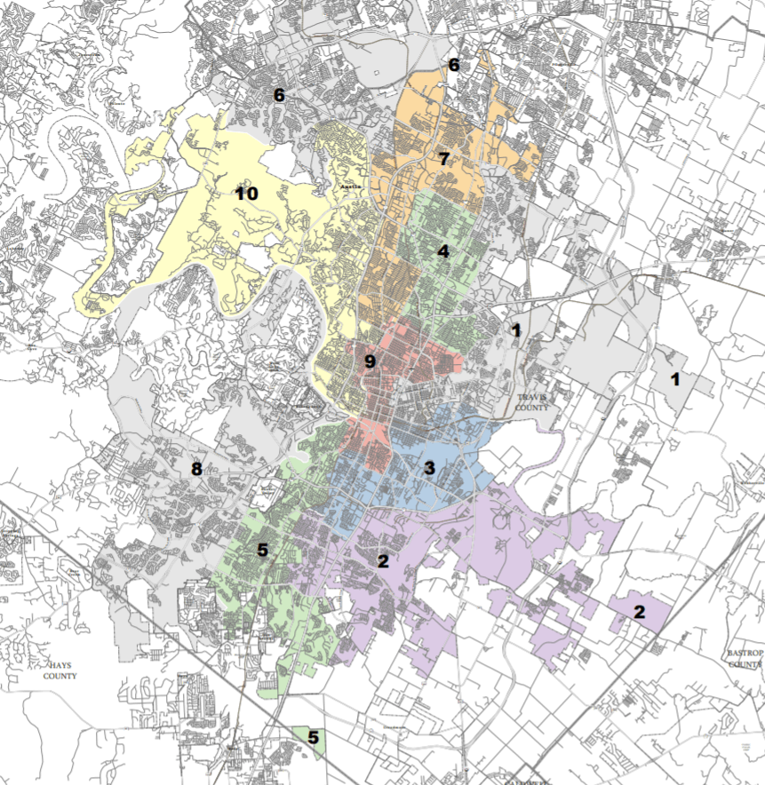
District 10’s footprint in Four Points appears to be getting much bigger.
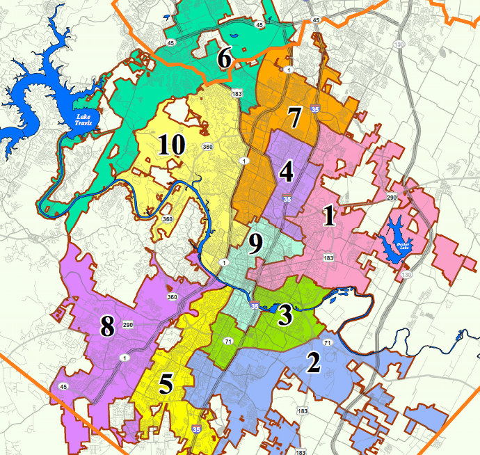
Preliminary maps during the Austin City Council redistricting cycle show District 10 boundaries taking over where District 6 boundaries have been in Four Points including sections of Steiner Ranch along Lake Austin, the Bend, River Ridge, parts of the Montview area and Comanche Trail, and Grandview Hills in addition to other small subdivisions.
Substantial population growth in Distict 6 is the main reason behind the shift. Northwest Austin’s District 6 is the largest geographic area in the city and it had more than 108,000 residents in 2020.
“As the current District 10 council member, I work daily with my own constituents, with those who neighbor District 10, and with Austinites across the city as well,” said Alison Alter Council Member, District 10. “The central and northwest Austin communities have a long history of working together, and in my time in office I have worked closely with District 6 leaders and community members to oppose irresponsible development near Milky Way Drive, to mitigate wildfire risks in the area, and to preserve environmentally sensitive land along Bull Creek. No matter how Austin’s Council districts are ultimately drawn, we will continue to work together within and across district boundaries to help everyone.”
The redrawn districts will have between just over 99,000 and 94,000 residents each, meeting the guidelines of less than 10 percent difference among all 10 districts, according to the Austin Monitor.
“The need to move roughly 12,000 residents out of District 6 created what commission members referred to as a “domino effect” of shifting the boundaries of districts 10, 7 and 8, which all grew, though at a slower rate,” stated the Austin Monitor.