

By LYNETTE HAALAND,
Four Points News
*Update: Friday, Jun. 10, Lake Travis was reopened to boat traffic.
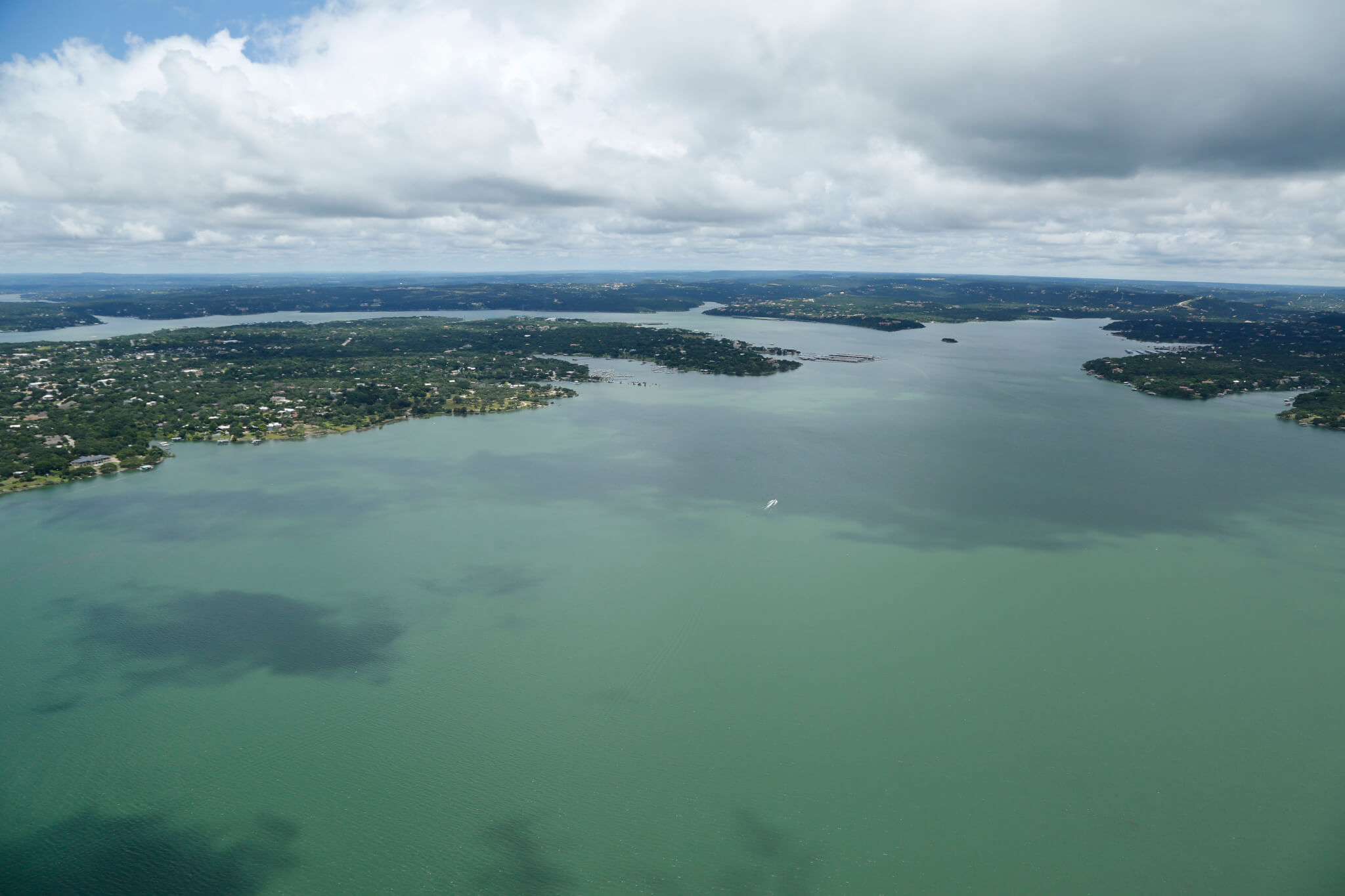
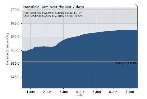
Lake Travis was closed on Monday to recreational boat traffic as the elevation rose to 692.69 feet above mean sea level. High lake levels are causing increased hazards including debris such as tree branches, signs and picnic tables.
“We are closing Lake Travis to recreational boat traffic because of increased hazards due to submerged items, and for the detrimental effects wave and wake traffic has on property,” said
John Hofmann, executive vice president for water at the Lower Colorado River Authority. LCRA held a press conference on Monday afternoon at Mansfield Dam Park.
“The higher the level, the more items are submerged and in some cases only partially submerged, because it creates a whole new set of navigational hazards, it represents significant additional opportunities for hazards on the lake,” Hofmann said.
LCRA lake rangers will be patrolling the lake by boat. A violation of this ban is a class C misdemeanor and punishable by a $500 fine.
Lake Travis is closed indefinitely. Hofmann could not say how long LCRA expects to have the boating ban in place.
“The ban will depend on the hazards and how quickly the lake ends up coming down,” Hofmann said. “We will evaluate on a day by day basis, it depends on what we see with the submerged hazards.”
Hofmann indicated that the closure of Lake Travis will not affect the whole summer. The forecast this week includes sunny days and dry conditions but this is Central Texas and that could change, he added.
“We are going in our third week of flood operations, and the Colorado River system still has a lot of water coming into it,” Hofmann said. Even when the rain stops, LCRA continues to be in flood operations and expects to be for the next several weeks.
The waters at Lake Travis are rising because of the rains that have occurred upstream of Lake Travis.
“We continue to have a large amount of inflows coming from the northernmost parts of the Colorado River watershed… extending up toward Brownwood,” Hofmann said.
As soon as it is safe to do so, LCRA will pull down the flood pool of Lake Travis but right now is the rainy season and the beginning of hurricane season, Hofmann said.
“Mansfield Dam has three full floodgates and one small floodgate open for a total discharge of 25,000 cubic feet per second, that’s roughly the same amount of 17 Olympic-size swimming pools,” Hofmann said.
Floodgate operations also continue at Buchanan, Wirtz, Starcke and Tom Miller dams along the Highland Lakes. Water also is flowing over the designated spillway at Inks Dam, which has no floodgates.
The flood pool of Lake Travis is anything between the elevation of 681 feet and 714 feet above mean sea level. Lake levels reached 692.69 on Tuesday morning.
The Mansfield Dam spillway is 714 feet and the closest waters came to the top of the spillway was in the 1991 Christmas flood when Lake Travis levels reached 710.4 feet above mean sea level, Hofmann said.
Lake Travis is a water-supply reservoir and has a flood control component. It will fluctuate a great deal like it has in the past several years.
“This is exactly the kinds of extremes in weather that we see within a 12 month period. A year ago, we were looking at a lake that was over 50 feet lower that what it is today,” Hofmann said.
“That is why we live in an area known as ‘Flash Flood Alley,’ and why it continues to be a beautiful and yet sometimes dangerous place for us to live,” he said.
In recent years, Lake Travis was partially closed in 2011 with Labor Day Weekend fires and then the last time the lake was closed was 2007.
Inks Lake and lakes Marble Falls and LBJ are also closed to recreational boating.
Lake level projections are updated frequently. For information on current lake levels and the latest lake level projections, visit the flood operations report at www.LCRA.org .